Tag Archives: hiking

The Bromo Tengger Semeru National Park

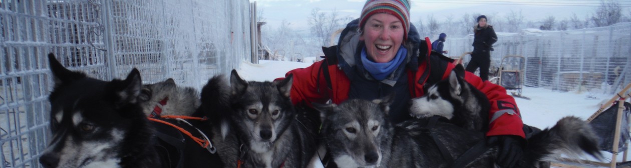
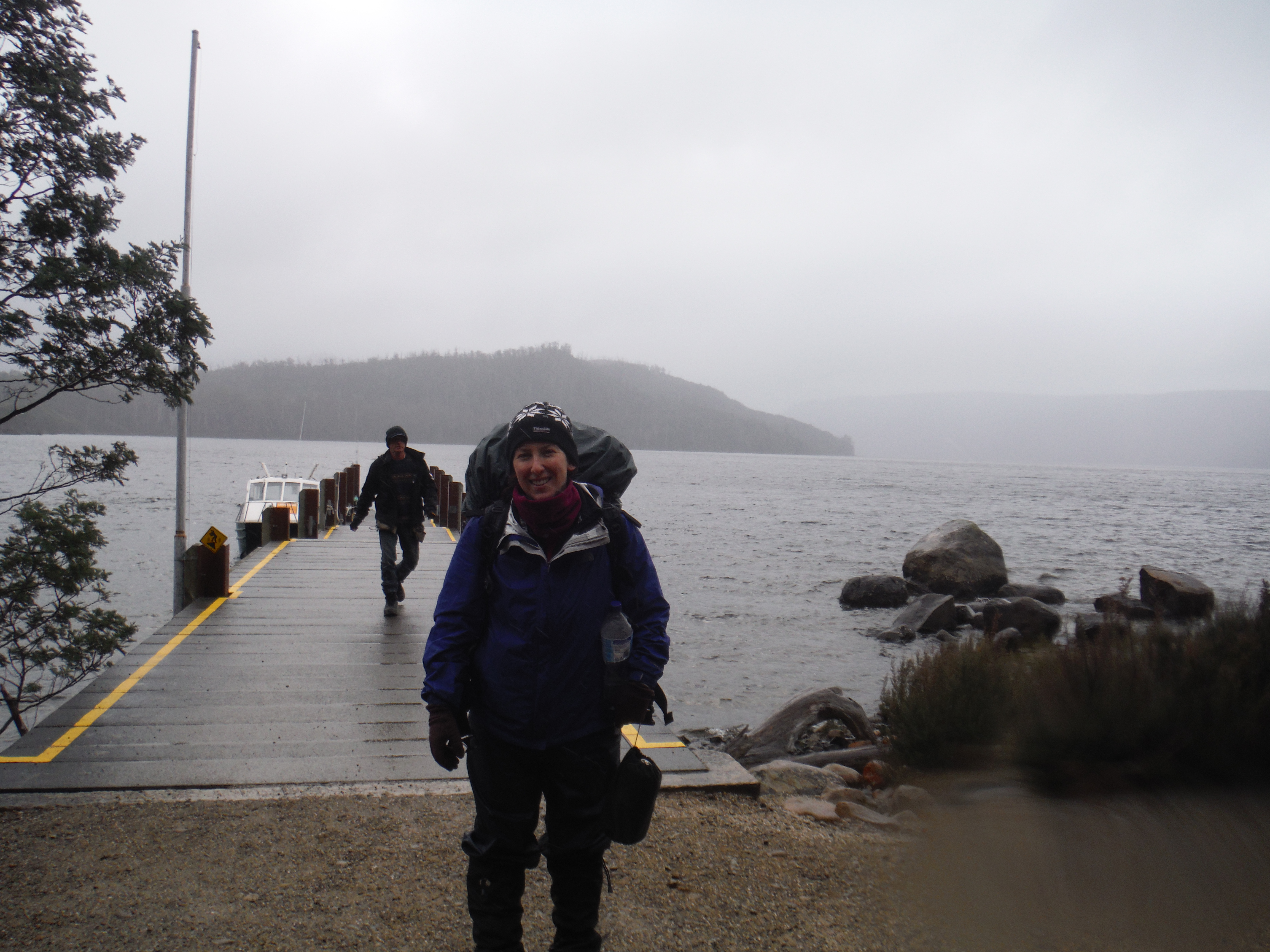
Undoubtedly one of the most spectacular places I have ever visited is the Bromo Tengger Semeru National Park in Indonesia. I arrived on the shuttle bus late after driving through the dark hills around the bends up towards the township of Cemero Lawang. I checked into the Cemara Indah Hotel and got an early night as the trekking was to start at 3am the following morning.

As I woke up, dressed and headed out into the ‘chilly by Indonesian standards’ weather, I was greeted by some locals outside selling hats and transport. They were trying to convince me that five kilometers was too far to walk up the hill to see the sunrise and as such I needed to take a jeep. They were also trying to convince me that despite my layering in gear I am taking to Nepal for my basecamp hiking, that I was going to be waaaaayyy too cold and needed to buy another jacket, a scarf and a hat from them. I laughed, told them no and that I would be fine and started my way along the road in the dark alone towards the top of Mount Pananjakan with my head torch.

About half way up the hill I met two guys, Roland, a 60 year old from Italy and Ciaran, from England. While we bonded over cup noodle breakfast and their horrendous coffee, we decided that we would all go walking together for the sunrise.

bromo taman nasional 014
The beginnings of sunrise over Bromo. Excited, but still can’t see her yet!

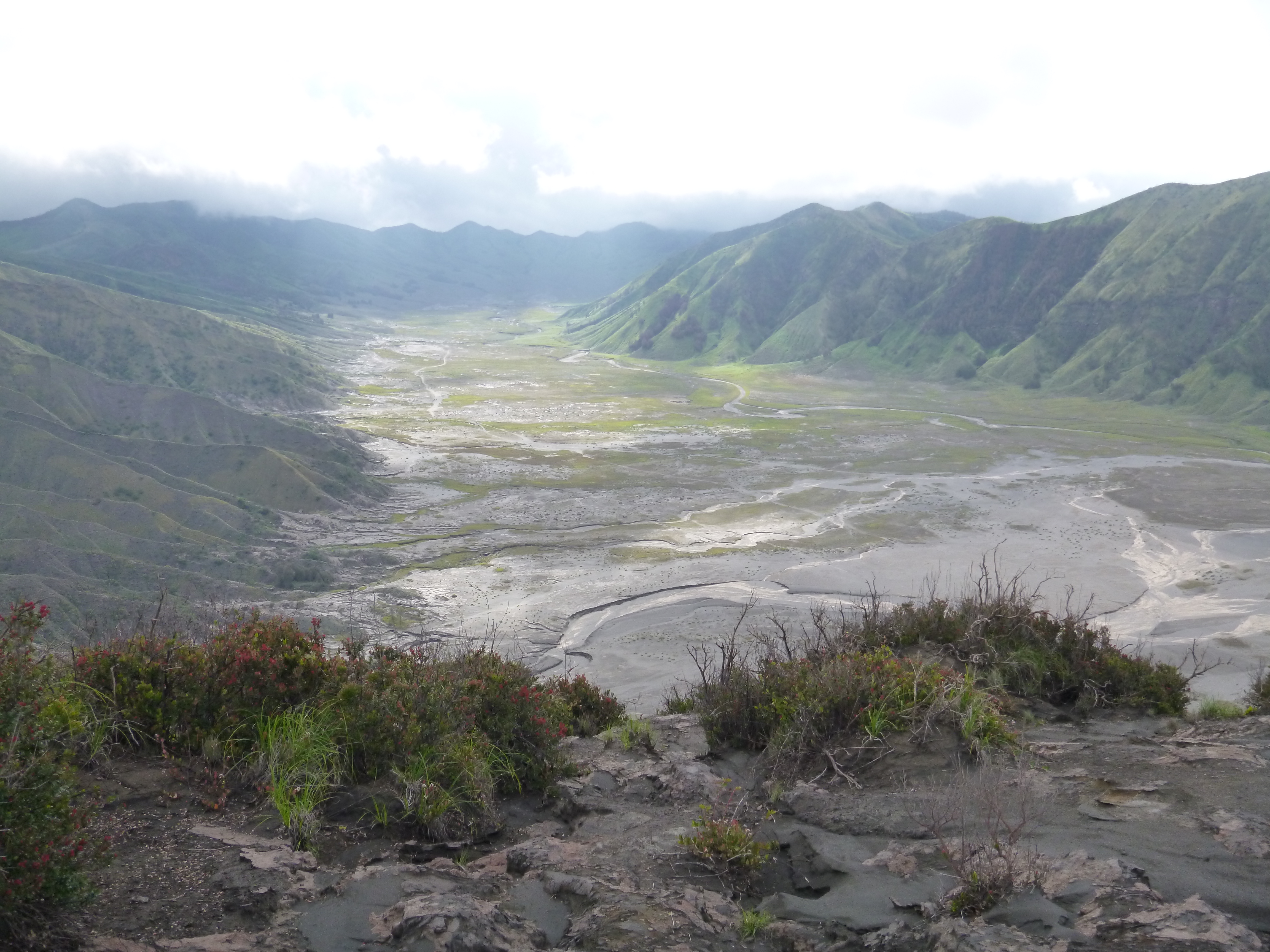
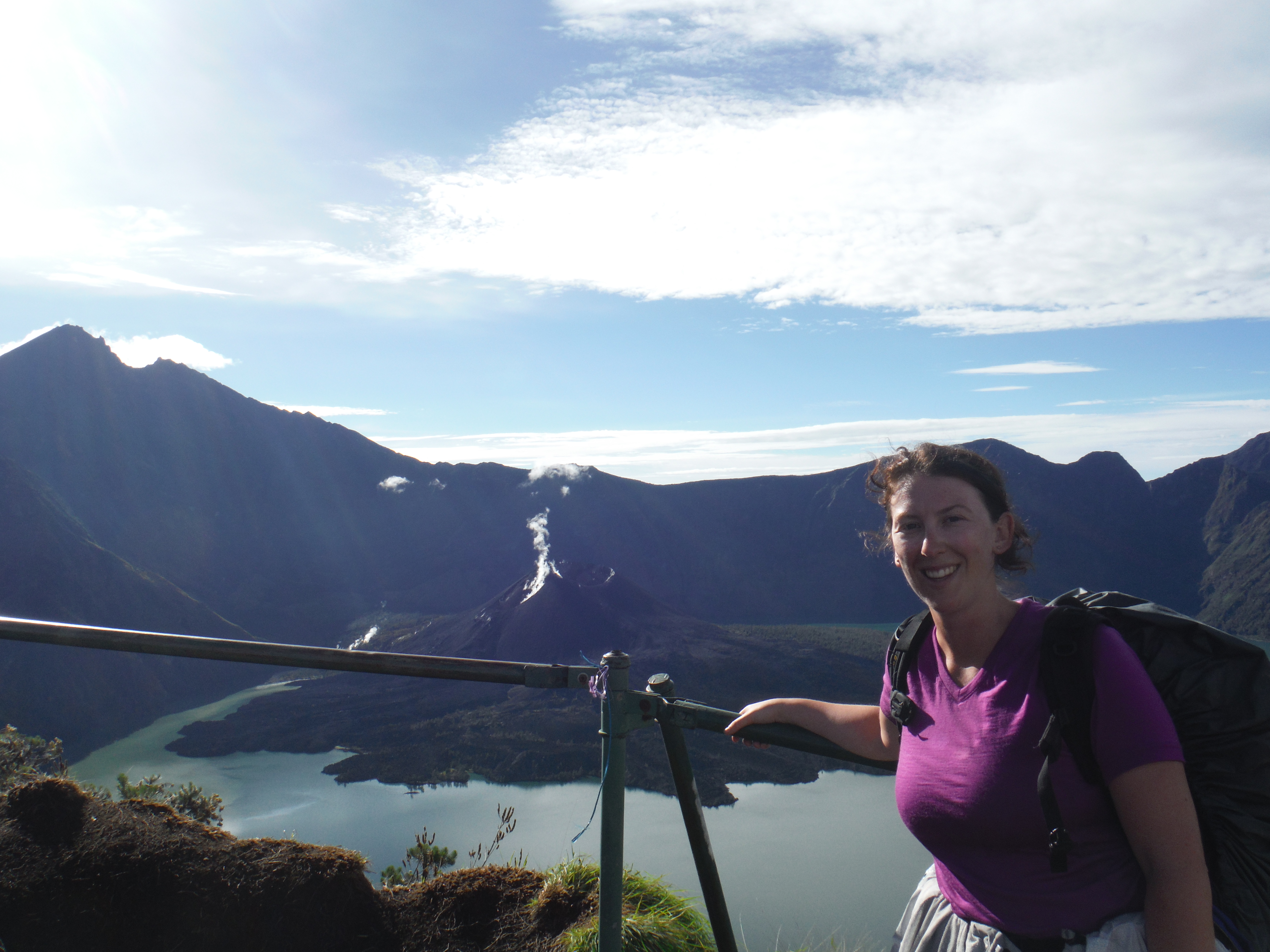
And so up the hill we went. We arrived at the View Point 1 eventually after taking a bush trail up from the road and sat to watch the amazing sun rise over what was to be my first glimpse of the mountains since I had arrived. They weren’t to disappoint. The view was crystal clear and as far as the eye could see across the valley. Batok stood out right in the centre as the near perfect conical shape with ripples down its sides. Bromo to the left chugged with its smoke up into the atmosphere. The stunning Semeru sat in the far background casting an eye over all of the rest of the mountains with its tall chuffing summit. We took pictures for a long while before heading up to the summit of Pananjakan after all of the jeeps with the tourist brigade had left to go down into the valley. It meant that we had the entire summit to ourselves and it was blissful as you could see the entire way around the area as Pananjakan is the tallest mountain in that vicinity besides Semeru.

bromo taman nasional 035
And there she was….. Batok in front, Bromo off to the left side and Semeru in the distance peeking over the back

We made the rookie error of underestimating how far we would have to walk before entering down into the valley. The hill just kept on going and going and going and eventually a jeep stopped and offered us a free lift down to the base of Mt Bromo on the valley floor. We jumped in and drove a couple of kilometers the rest of the way down before walking out of the valley to go and get breakfast. The day was still young, it was only 9am and there was still plenty more adventuring to be had.

bromo taman nasional 081
From the valley floor, Batok going up to the right, and Mount Bromo straight ahead with its blown out crater

I don’t think I had eaten that much in ages as I chewed down two bowls of rice, a bowl of noodles, a stack of fruit and two cups of tea. Then it was back out again into the crater.

The first mission was to get up to the crater rim of Mount Bromo. Along the way we met some locals who wanted to take pictures with us so after that we walked with them up to the top. Bromo was spewing a whole bunch of smoke out and it was a beautiful reminder of our insignificance on this Earth. It is so much more powerful than you or I and has the ability to destroy rapidly what we have spent generations achieving. I never fail to be in awe.

bromo taman nasional 140
Giant hole to middle earth… just wow!

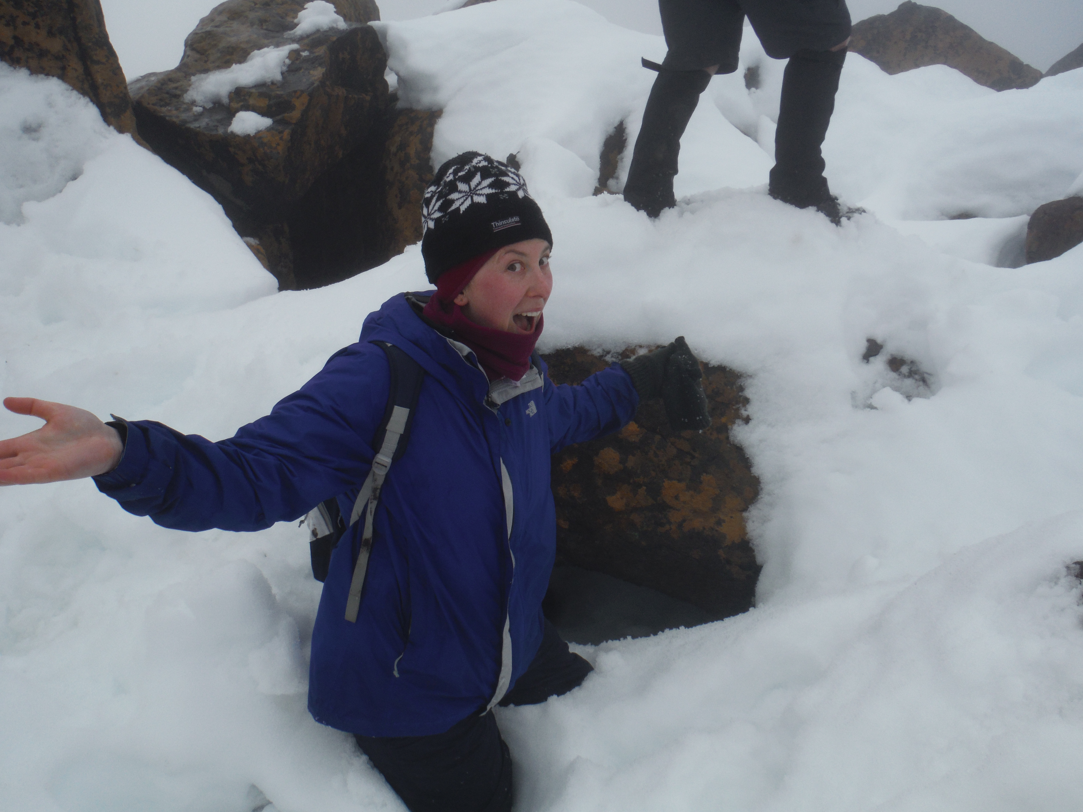
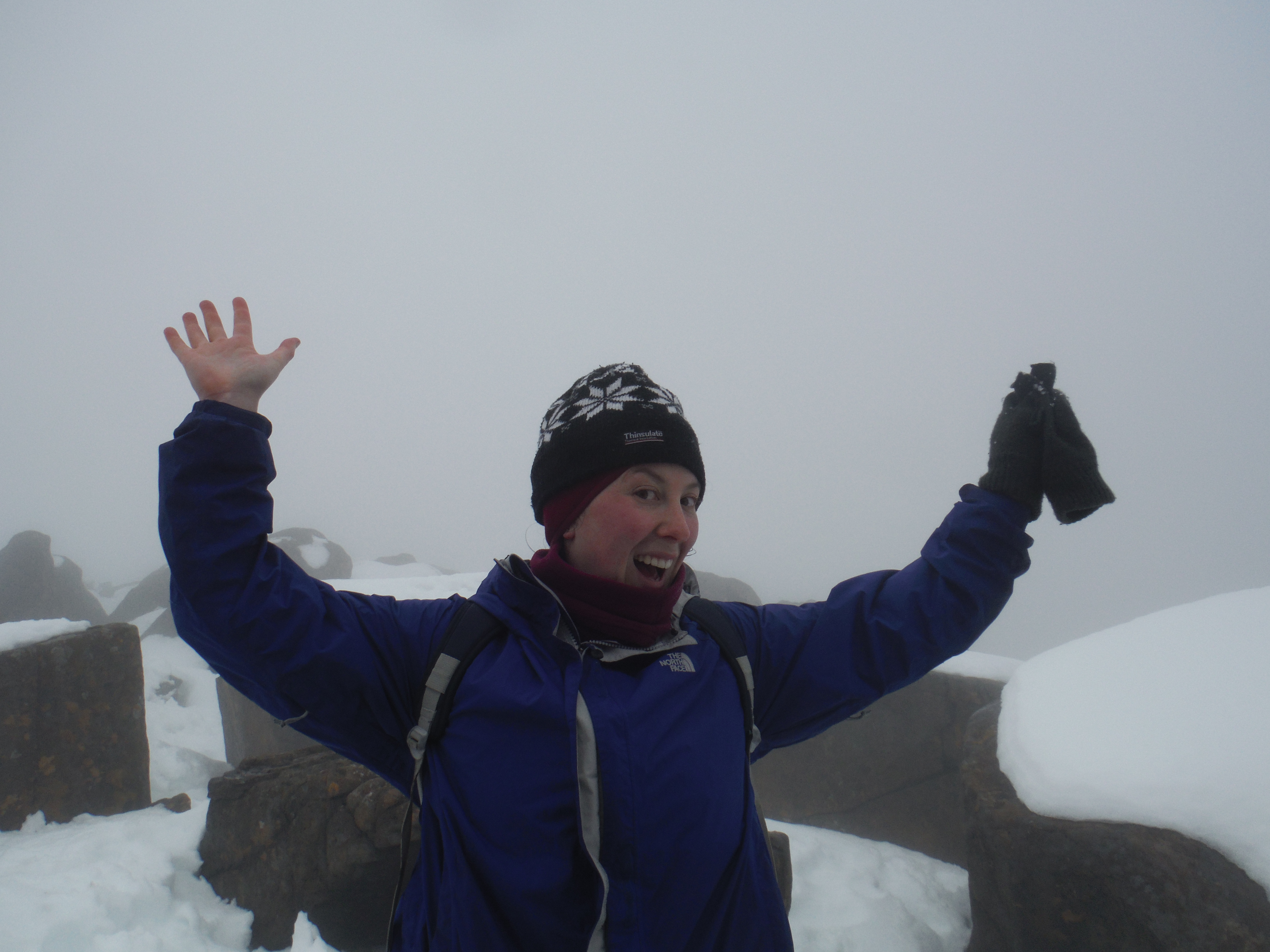
After we trotted down the side of Bromo there was debate about whether we should try and climb Batok also. It is the steepest and hardest climb of the three mountains but we decided to go part of the way and see how it was. Of course part of the way turns into massive rock climbing and “well we have come this far so screw it we are going to the top!”

bromo taman nasional 118
Mount Batok with the Hindu temple in front.

I am incredibly glad that we did as the views from here were just spectacular. The summit was a giant plateau that you could walk around and it gave you 360 degree views of the entire valley floor if you walked around the top. We stayed here until the sun was about set before scampering down to the bottom and then back along the valley floor to the hotel at about 4:30pm.

bromo taman nasional 195
The other side of the valley as seen from the top of Mount Batok

Our day was nearly 14 hours long, 3 mountain summits and about 20 kilometers of walking later. But as stuffed as I was from all of the hiking, I was also super excited and relaxed. It was one of the most incredible days of hiking that I have ever done. It is hard to not be impressed by the stunning views that this area has to offer.

The Perilous Summit of Mount Rinjani – Part 2

I barely slept. I rolled around exhausted and as much as my body was exhausted, it would not allow me to sleep. Before I knew it, I was waking up at 1:30am waiting for the moment to get out of bed and to go and summit this mountain top that everybody keeps on telling me is so difficult that it is ridiculous. Way harder than the previous days…. 

I started ‘breakfast’ with a hot tea and a couple of sugar cookies and packed a hydralyte for the way. At 2:30am I started out with Chris up the hill. The others were way faster than us and so they were set to start out later and meet us. The first part of the trek was on a massive incline crawling over rocks and sandy scree to try and get to the crater rim. After about an hour, it was over and we were making our way along the crater rim at a more moderate incline. It was windy, it was dark and even though I couldn’t see much, I could see that the trail either side of me lead to a massive fall either down the outside of the volcano or into the crater. I tried not to think about it and kept on going. As I kept going all I could think to myself was the song ‘ants go marching one by one, hurrah, hurrah’ as I could see all of these tiny headlamp glows following one another up a hill like small ants.

Gili T and Rinjani 132
The view on the way up as the sun starts appearing and it gets light enough to see

We sat and ate some more sugar cookies before what was to be the final hour and a bit. The most difficult part. Straight up to the summit over black sand. It was three steps at a time, then two breaths, three steps, then two breaths. At one point the adrenaline kicked in through all of the hard work and my frustrations and I realized that I was going to make it. I started getting excited. I could see Chris up ahead and he was rounding the corner to where the last stretch of the summit was. Almost there…

And then I saw it… Three French guys and an Aussie in shorts and a singlet at the top of the mountain in a man huddle to try and stay warm and I knew I was there! The view was incredible. Chris and I stood at the top and had a few pictures with the sign at the top over the view of the lake and at that moment I was so elated that something I had wanted to give up after one hour of walking on day one I managed to achieve through sheer will power and mind control. It was one of my greatest achievements.

Gili T and Rinjani 146
Yay! I made it to the top!

The sun didn’t rise properly as there were too many clouds in the distance obscuring the sun. But I could see Gunung Anung on Bali, the Gili Islands, all the way across the northern coast of Lombok and Sumbawa where I was taking a boat trip in two days from that moment. The time up there was fleeting and never enough, but we gradually started to make our way down, taking pictures of all of the things that we didn’t see in the dark on the way up. After a couple of hours we were back at camp, eating breakfast and packing up to start the trek back down to Sembulan.

Gili T and Rinjani 162
Views of the valley on the way down

It was a steep descent. My knees, ankles and feet were killing me. But I kept on plodding along. After ten hours of walking that day, I managed to get out the end of the rice and farming fields to the road where the truck was waiting to take us back to Senaru.

Gili T and Rinjani 220
The rice fields in Sembulan towards the end of the hike

We sat in the back of the truck and waved to the kids through all of the villages screaming ‘Hello!’ at us along the way and eventually got to Senaru, picked up our luggage and headed to Senggigi where we were staying the night. The whole adventure at this point never felt like it actually happened. It felt like a dream…. except I had two giant swollen feet from the rapid change in altitude and a duck waddle when I walked for the next two days to remind me.

Gili T and Rinjani 224
Now dems are some serious cankles 🙂

This is something I laughed about despite my discomfort. Because I took on Rinjani. And despite my own self doubt, I won!

The Perilous Summit of Mount Rinjani – Part 1

From 600m to 3726m in less than 48 hours. It was going to be one of the most challenging feats I had ever encountered. Welcome to Mount Rinjani, Indonesia!

As I sat at the bar talking to a random guy in Gili Trawangan about trekking around the area and told him that I was going to hike Mount Rinjani he enlightens me that it is one hell of a tough trek. Forget the Annapurna Circuit and Everest Basecamp in Nepal, forget the tallest mountain in the region Kinabalu, Rinjani is way tougher. It is purely brutal. And so I started quaking in my pants worried about whether or not this is actually achievable. But the money was paid up and we were leaving in the morning so I was going to give it a decent go.

7am we headed down to the boat docks to try and find our boat. Confused about where we were supposed to be going, we eventually found our travel agent, Andy and he has shuffled us onto the local boat over to Bangsal. I sat at the end of the boat with my friend on one side and a local man asleep on my other shoulder for some unknown reason and we sailed on. As the only white people on the boat we were an easy spot for the men down the beach calling to us “Danni and Beccy!! Danni and Beccy!!” They helped us into a horse drawn carriage where we were taken to our breakfast point for our first meal of the day.

Gili T and Rinjani 025
Off down the road in our horse drawn cart

From here it was two hours in a car driving to Senaru to begin the hike. We madly threw things into our bag so that we could get started with our porter as the rest of the group we were with had already begun walking two hours before us.

Gili T and Rinjani 030
The entrance gate to the Mount Rinjani trek

As I started up the hill, it was brutally hot and quite steep. I remember thinking to myself in that first hour, if this is what the easy part is like, then kill me now because I will never make it. I was ready to throw in the towel, but at the same time I figured my body would become accustomed to it eventually and all I had to do was keep walking and to push through it. During the second hour I was really starting to feel the effects of not having had enough to eat before I started to hike and I am saying to my porter who doesn’t speak English the only thing I remembered in Indonesian from my market visit that I knew he had. “Pisang? Pisang? Terima Kasih!?” I said to him and he shook his head at me knowingly and pulled out a couple of bananas for me to eat. I sighed relief and kept walking.

Further relief came in the form of the torrential downpour of the wet season that could be trusted to begin at approximately 1pm every day. As the rain started teaming down, the trail became a river bed to walk up and the weather cooled down to the point where walking at this incline became more manageable for me. On the downside, my boots and a lot of what I owned had gotten wet, but that was bound to happen at some point anyway.

Gili T and Rinjani 032
One of the rest spots on the way up

Along the way we stopped at the rest points Pos I and Pos II and met some really cool people who imparted advice and gave us left over cookies that were to be pivotal to my quest later. Eventually we made it to the lunch spot and the rest of our group and munched down on some well needed and deserved noodles. And then it was time to continue. At the lunch spot we’re at 1500m above sea level. We started at 600m, we were camping at approximately 2400m, so we were about half way up in the incline stakes. And so the plodding, one foot after another kept on, and I kept on even though I was well further back from the group than the others due to my breathing limitations.

Eventually we made it to the camping place for the first night. The porters had set up our tents in a line across the hill and we all got our drenched clothes off and attempted to get warm. My bag had gotten wet around the sides of my pack cover and my pyjamas had gotten wet also so I took to sleeping in a pair of rain pants…. funny I know considering I probably should have worn them in the rain. Dinner was quickly scoffed down and everybody retired to bed exhausted after a massive first day.


Gili T and Rinjani 050
Tents in a line along the hill

The next day was to offer a bit of relief in the form of downhill, for which I was excited. We were told that it was to be a pretty hairy ordeal though with very slippery and steep rock faces. We weren’t to be disappointed.

The day started with a 200m climb straight up from our camping spot to the crater rim where we glimpsed our first view over the incredible crater lake with Gunung Baru in the centre chuffing hot smoke.

Gili T and Rinjani 057
My first glimpse of Gunung Baru in the centre of the Mount Rinjani crater lake

From here it was down into the crater to the edge of the lake over the aforementioned steep and rocky track before arriving at the bottom. I took my shoes off and had a bit of a paddle in the lake to cool down the feet before we moved on to our lunch spot and on to swimming in the hot springs. The hot springs were the most amazingly warm hot bath at that time ever and a Godsend for sore muscles. We sat in and among the hot waterfalls and relaxed for half an hour while lunch cooked and then it was time to eat.

Gili T and Rinjani 101
The glorious hot springs, amazing for tired and sore muscles

The saddest part about this whole area is the amount of trash lying around. The locals seem to have very little regard for the nature and very little understanding of the effects of pollution. It had drawn in a whole bunch of monkeys and flies around the area that were pests in trying to get at your food. One monkey waited until I wasn’t looking, came right up beside me and stole the chicken bone that I had set beside me when I was done with it. Another of the monkeys approached me while I had a chicken bone and was getting ready to charge me. I screamed and yelled at it, waving my arms about the place letting him know who’s boss for showing his teeth at me and charging at me. It is such a shame that it is getting this way. There is nothing that saddens me more than watching these monkeys ferret through left over plastic bags for food in a place that looks like a rubbish dump.

Gili T and Rinjani 107
Monkey contemplating taking my lunch

And so from here we continued. Another brutal climb up sheer rock face for the next three hours to reach our camping spot for the evening. And while it was difficult, the rain held off just enough so that we could get there without too much swimming uphill into gushing water as we had heard happened to others doing this trek before us.

We set up camp, we ate dinner, we prepared. Tomorrow was the big one. The summit. We were sitting at 2600m above sea level at the base camp for the summit. A gruelling 1100m ascent in 3 and a half hours that is to be climbed over volcanic ash and scree. We were to be up at 2am to start the climb by 2:30am to get there for sunrise.

Gili T and Rinjani 126
The final supper before summit, with amazing view to accompany

For my summit climb and to see if I made it to the top, catch us next week!

Central New South Wales Adventures

I decided on my latest sabbatical from school to do a whirlwind tour to visit friends in Melbourne, travel by train and bus up to Orange in Central New South Wales to visit my little brother and then over to Sydney to fly home for the start of the new term.

Big cities are big cities. And while they were fun, they were pretty standard. Not a great deal new to expect. The real adventure was in the exploration of the bush and surroundings of the small towns and parks around Orange, of which I got to explore for five glorious days.

My first adventure was to the town of Bathurst a couple of days out from the world famous Bathurst car race at Mount Panorama. I tried to drive around the track, but parts of it were closed off so I did some driving over the finish line and for the rest of it we walked around the entire track. It was a beautiful day and the views were spectacular. On my walk, I discovered that Australian’s are such massive alcoholics that to get around the ‘one slab of beer per person per day’ rule they impose in the camping areas around the track that the locals would go into this region which is completely open to the public outside of race week, dig a hole in the ground near their camping spot and then bury bottles of spirits in the ground to come back and dig up several weeks later when the event is on. Kind of like a treasure hunt for alcoholics….. “Now where did I hide my rum again?” If there is one thing that I can attribute to my peoples, it is that we certainly know how to hide our alcohol and have a multitude of inventive and imaginative ways of sneaking it into events.

melbs and orange 060
Speeding over the Bathurst finish line at Mount Panorama

My second day was spent hiking around the Mount Canobolas State Park. I went around the Federal Falls loop and then down to the Hopetoun Falls. There were wild mountain goats floating around and I saw a few echidnas on the track, but mostly I was fearful of coming across snakes. Snake season is upon us and it is not good to be out bush on your own treading on snakes.

melbs and orange 159
Wild goats ‘just chillin’ at Mount Canobolas

The Federal Falls were stunning. They were a drizzle of the top of the cliff face at best because there had been little rain, but you could crawl around the rocks into a cave that is hidden at the back of the waterfall and hang out there for a while. It was beautiful. A very steep climb back up the hill and then it was off on another steep hill down to the Hopetoun Falls, which I must admit were a little bit disappointing compared to the Federal Falls. Back up another gruelling hill to the car and we are off to the next adventure, only half stuffed.

melbs and orange 165
Federal Falls

I met up with my brother late in the afternoon and we decided to go four-wheel driving through the abandoned gold mines at Ophir. On the way we stopped at Banjo Patterson Park to see the place where he was born. For those of you who don’t know, he was a poetic rocking legend back in his days and wrote the lyrics to Waltzing Matilda, undoubtedly Australia’s unofficial national anthem.

melbs and orange 180
Banjo Patterson Park Memorial Statue.. and my brothers dog investigating the scene…

So off to Ophir Gold Mines. These mines were the first payable mines in Australia and are crazy to explore. In some areas you will be walking around and there will be giant holes drilled down into the ground where people had just dug downward in an attempt to find a quartz seam which is where most of the gold accumulates. There are also mine shafts that have been dug into the sides of the very steep cliff faces. He was telling me about the world’s largest nugget being found here. Rumour has it that the guy who found it didn’t want his wife to know about it as he planned to divorce her so he buried it under a tree, told a close friend about it and then a couple of months later he died. The friend who he had told about the nugget went out with his son around the area they were told the nugget was and started digging around the base of the trees until they found it. According to the locals, it was the son’s discovery, but the father took credit for it. All local stories, which are pretty cool and you wouldn’t normally know about unless you were in with a local.

melbs and orange 191
One of the old mine shafts at Ophir Gold Fields

So after nearly getting bogged, blowing up the gearbox in my brothers truck, exploring a whole bunch of mines and not finding anything of great value, we headed back to Orange to contemplate the following days activities.

Being a bit of a science nerd, there was no way I was going to come out this way and not make a trip to the famous “Dish”. For those of you who don’t know and are not familiar with the Australian movie “The Dish”, the broadcast of the first moon walk by Neil Armstrong and Buzz Aldrin on the 20th July, 1969, to televisions all over the world came from this CSIRO satellite dish at Parkes. It is crazy to think that this parabolic piece of metal sticking out into the sky could be responsible for such an amazingly large feat at a time when our world was only just starting to get a grip on many different kinds of modern technologies like television, but I was pretty chuffed to be there and my brother got up to mischief while I ran around and read every surface of writing and played with every interactive display.

melbs and orange 210
Hanging out at “The Dish”

On the way home from Parkes, we stopped in at the Borenore Caves only about twenty minutes out of Orange. For a free cave I didn’t expect very much, but these caves were a total hidden gem. The large open caverns and beautiful formations of stalactites and stalagmites made it one of the best caves I have ever explored. We crawled through lots of holes and up and into small caverns exploring where every single passage in the cave lead to. It was such a rarity to find something in nature this fabulous that you aren’t charged a bucket load of money to go visit and isn’t riddled with tourists. We were the only people there and had the caves all to ourselves.

melbs and orange 228
Borenore Caves

My last area of exploration around this region was just out of Katoomba at the Blue Mountains National Park. I spent one full day hanging out at Scenic World and riding the cable cars and the worlds steepest train among the mass amounts of hiking I did through the valley floor along the side of the famous Three Sisters. Given that I am in somewhat of a training mode for my pending Mount Everest Base Camp trip I decided that this time I was going to navigate my way up the famous ‘giant staircase’. It tells me on the sign that it is a 400m ascent of over 900 stairs… other signs told me different things but it was supposed to take 45 minutes according to the sign. Well imagine my surprise when I managed to mount those three sisters in just over twenty minutes. Feeling pretty chuffed with myself, I went in search of food in the form of KFC chicken nuggets…. hard work undone.

melbs and orange 120
The Three Sisters I just mounted and I 😀

Another hike around this area was the Wentworth Falls hike that I did with my brother on the last day before I caught the train out to Sydney. This by far was the most spectacular hike I have done in a very long time. You climb down steep ladders to get to the valley floor and along the way you hike along paths that have been carved into the cliff faces by workers. They are really incredibly spectacular. The falls themselves were stunning and have multiple tiers, all of which are different. At the bottom of some of the falls you will find shallow pools that you can swim in or stand under the falls but you have to be super careful of the slippery rocks.

melbs and orange 259
Wentworth Falls

As we weaved our way further into the valley floor, my brother laughing every time we went further down on yet another staircase knowing that meant another staircase to go up, we reached the bottom of the falls and the lowest part of the trail. We traced it through the forest and around the cliff faces until we found the parts to start climbing up. It was not as bad of a climb as I had anticipated, and the waterfalls and cliff faces on the way up were different to the ones we experienced on our way down. Within three hours we had smashed it and were back to the car. Time for me to get on a train and make my way back to the city.

The Overland Track Part Three – The Final Descent

Day Four

After climbing Mount Ossa it was time to get a move on to the Kia Ora Hut. My shoes and my pants were drenched from climbing Mount Ossa in the snow, namely from falling in holes and sliding down it on my butt. We were on limited time, my feet were aching and the track was terrible. There were many places filled with deep mud puddles, tree roots and really unstable track. I started to fret that I was not going to make it to camp as it got darker and darker outside. It got to the point where I could barely see where I was going and about to take my headlight out of my pack. With five minutes of daylight to spare, I rolled into the hut, cranky, tired and thankful that I was not trying to navigate bush in the dark .

The surroundings of the hut was full of animals and I saw a wombat and a couple of possums fighting with each other up a tree. Given the atrocious state of my shoes, I cut up my seating foam and made a pair of makeshift flip flops. My body is starting to adjust to the long distances and the pack. I actually felt pretty good at the end of the day before heading to bed.

Overland Track 239
A possum kicking around the water tank

Day Five

Today was themed ‘Waterfall Side Trip Day’. The walking distance was only 9km between the huts but there were several small side trips to different waterfalls along the way. Despite the drenched shoes, I made pretty good pace and was feeling quite good.

Overland Track 244
Du Cane Hut

The first waterfall that we went to visit was D’Alton Falls which were just spectacular. I could stand on the ledge that is the viewpoint all day and watch. The Ferguson Falls along the same track were also amazing, but not quite as good as these. Waterfalls in Tasmania are world class. As good as any I have seen travelling the world and totally pristine.

Overland Track 257
D’Alton Falls

After a quick lunch, we moved on to the next waterfall, the Harnett Falls which were difficult to see at points, but the boys managed to scale their way down and along the river to get to a good vantage point.

Overland Track 286
Harnett Falls

Another hour or so saw us arrive at the Bert Nichols Hut, which I must say is the Hilton of Overland Track huts. The place was huge, decorated with beautiful art decorations on the ceiling. On the walls was information about the man for which the hut was named. Bert Nichols, the pioneer of the Overland Track, the man who knew the countryside here best and mapped the track. Described as one of the “most cunning and most cleverest man who ever was” for his keen poaching and survival skills, Bert is one of the biggest reasons that this walk exists and it is now known as one of the best in the world today.

The only issue with this stunning hut is that there was no gas and as such, no heating at all throughout the entire building and the thermometer was reading at one degree celcius at six in the evening… It was destined to be a freezing cold night.

Day Six

The morning was stunning and clear with an immaculate view over the valley. It did however present with a few problems. Namely that overnight it got so cold that is froze solid both my shoes and my socks. It took me a good ten minutes of working the shoes with my barely warm hands to get them to become flexible enough to slide on my feet. And then so began the walking with feet that I couldn’t feel for a good part of the morning in the ice blocks.

Overland Track 301
Morning view from the Bert Nichols Hut.

With lack of feeling in the feet, I managed to smash it out to Pine Valley Hut in record pace. The walk through was stunning and over the top of a couple of swinging bridges and through orange fields and beautiful rain forest along the way. We were hoping that it would be clear enough to climb to the top of the Acropolis, but by the time we got there the familiar cloudy haze had set back in and there was nothing to see from the top so we decided to go down the path a short way to a waterfall where the boys decided to entertain themselves with yet another underpants shot.

Overland Track 325
Waterfalls on the Acropolis Trail

For the first time in six days, we had a coal heater with coal actually present in the hut. So the ten of us there hung all of our stinky clothes and boots out to dry and ramped up the heat. We sat around, played Yaniv, ate the last dehydrated meal of the trip and enjoyed the knowledge that there was only nine more kilometers to walk in the morning and it is all over.

Day Seven

The last day and it was the worst day for my feet. I woke up swollen from the top of my Achilles all the way down through my feet. It was painful and uncomfortable to walk but for some reason, the adrenaline of having nine kilometers to go and the familiarity of walking on sore feet made my body and mind adjust to the task before me.

Overland Track 348
The stunning path with orange plants along the Pine Valley Trail

Within three hours retracing our way back along the Pine Valley Hut trail and then legging it the south on the trail we made it to Narcissus Hut and called the ferry to come and collect us. We sat out on the dock in the rain waiting for the boat that drove us across Lake St. Clair. It was over and we had done it! 90km. 6 days of walking. An amazing adventure! All that was left to do was to drive over the Central Highlands home via a stop at The Wall at Derwent Bridge, an amazing 100m long wall of wood carvings by a local Tasmanian artist detailing the history of the Tasmanian Central Highlands, and at the Deloraine bakery to devour two meat pies. Real food!

Overland Track 365
Off the ferry at the end of the Overland Track, Lake St. Clair

Looking back on that week feels like a haze. It was one of the most mentally challenging and incredible weeks of my life. One that I am glad I decided to do. All there is left now are the pictures, the stories and the amazing memories. The pain of knees and feet and the mental slog lessens as the days have progressed until there will be no memories of that left at all. Just the memories of spectacular views, “going deep”, frozen shoes, cheeky birds and some amazing company along the way. This is what it is all about. This is life.

The Overland Track Part Two – Mount Ossa, The Top of Tassie

So I had to Google Mount Ossa and what it actually looks like later when I had gotten home because it was so overcast and cloudy that I could barely see most of it on the day we decided to climb it….. I didn’t know where the summit was, I had no idea where I was going. All I knew, was that I WAS GOING……

Mount Ossa on a clear day. Source http://upload.wikimedia.org/wikipedia/commons/f/f2/Mount_Ossa_Tasmania.jpg

Day Four

Day four started with me spending half an hour strapping my feet with bandaids and sports tape to try and protect them, a feat which I later discovered was futile. It was a two hour journey from the Pelion Hut up to the Pelion Gap. From here you can do two side trips. You can chose the path to the left which leads you up to the top of the stick pile on the hill that is Mount Pelion East, or you can choose to be bad ass and take the path on the right which leads to the summit of the tallest peak in Tasmania, Mount Ossa, standing at 1617m…. despite not being able to see it.

Overland Track 193
Mount Ossa somewhere in there…. obscured by quite a lot of low level cloud

So in the grand tradition of ‘don’t think, just do’, we took the path to the right. Firstly though, we had to cover our packs. Warning signs had been placed on the trails warning of the cunning currawongs, these glorious black birds that have evolved to learn how to undo zips on bags and go through all of your stuff. I put my pack cover over the top of my bag, put my bag down and started on my way.

Overland Track 095
Cheeky Bird Warning

Not being able to see what it is that you are climbing exactly makes things a little ambiguous. At first I thought we were going up Mount Doris. But then I realized that it was not high enough and going to be too easy, so around the side of Mount Doris we went and there we were, at the foot of Mount Ossa, ready to go.

Overland Track 199
Round The Side Of Mount Doris

About half way up, we started to encounter the snow and the low level cloud to the point where it became difficult to see anything more than the footprints in the snow in front of you, more snow and some rocks sticking out of it. The wind started roaring and it became difficult to climb. At one point I thought to myself, “I can’t do this. It is too dangerous. It is too windy. I can’t get up this channel that the wind is just beating down in”. Some of the girls we had been staying with in the hut came around the corner at the top and told us that the wind is not bad on the other side and all we had to do was to make it to the top of the narrow and windy alley. So we persisted. Slowly. Carefully. And eventually rounded the top of the wind tunnel into the haven of the wind-free other side of the mountain.

Overland Track 214
On the face heading towards the central channel. The infamous wind tunnel….

From here it was another half an hour of walking. As the days had progressed we had laughed about ‘going deep’, a term that we used every time somebody stepped into a puddle so deep that the muddy water seeped over the top of your boot and down into your shoes. This half an hour of walking took the term ‘going deep’ to a completely new level. At times the footing was so unstable you would find yourself ass deep in snow with your feet stuck and you would literally have to climb your way out.

Overland Track 225
“Going Deep”

At some point, the footprints in the snow stopped. And after consultation with the GPS, we realized that we were indeed at the top. 1617m, and the top of Tasmania. The boys took part in customary underpants photos and we started our way back down the hill.

Overland Track 222
At The Summit of Mount Ossa, 1617m

Given the downward momentum and that it was pretty hairy trying to walk down for fear of ‘going deep’ it was easier for the most part to slide down the snow on your butt trying to avoid rocks. It was actually really fun and in some places you could work up a bit of speed. We rounded the bend into the giant wind tunnel again, managed to get down safely and continued back down the hill.

An hour later, the rest of the world appeared out of the bottom of the clouds and the surreal feeling of being in the snow in a white out disappeared. It was back to business as usual, back to the packs, and back on the trail to get to the next hut, the Kia Ora hut.

Overland Track 229
The world reappearing from the under the bottom of a cloud

Only one thing was problematic….. those cheeky Currawongs! They had managed to evolve further to chewing through elastic to remove my pack cover, open my top zip, disperse my phone, wallet, toothpaste, hand sanitizer, toilet paper and anything else they could get their grubby beaks on all over the platform. Despite not being the only one who had their pack broken into for the day (it happened to about five people), I would never hear the end of it. “Forget being smarter than a fifth grader, because you aren’t smarter than a bird”.

Stay tuned for the final installment of the Overland Track……

The Overland Track Part One…. And So The Adventure Begins

6 days. 4 boys that call themselves the “Trail Smashing Mega Blokes” and a girl. Approximately 90km. Four waterfalls. One mountain summit. Voted one of the top ten walks in the world. Welcome to the Overland Track, deep in the heart of the Tasmanian Wilderness!

The Start Of The Overland Track At Ronny Creek

It had been on the bucket list for years and this time I decided that while spending some time at home I was going to do it! So I put out the call for others to come along on Facebook and found some friends from high school I hadn’t seen in years who were keen. That is it! We’re going! It’s on!

Day One

And so I set off in the 4WD through the amazing Central Highlands from Launceston to Lake St. Clair to meet up with the others coming up from Hobart. After meeting we drove the winding roads up through to the small mining town of Queenstown for lunch before continuing on to Cradle Mountain National Park.

Queenstown Main Street

Post checking into our accommodation and organizing all of our packs and who was carrying what, came the last supper. Dinner consisted of a giant BBQ plate of meat, a luxury food not afforded to us for the next 6 days followed by the most ridiculous game of ‘spoons’ you have ever seen (spoons literally flying around the kitchen) and the last nights’ sleep in a real bed.

Day Two

I started the morning off with a Redbull poured into a glass and handed to me while I was still in bed. It was freezing and motivation at that point to get out of bed was low. Add the caffeine kickstart and we are up and at ’em!

We started at the Ronny Creek Car Park at 7:30am. Spirits were high, there was excitement in the air. We hiked through the grasslands up into the rain forest and then up around to the stunning views over Crater Lake. The packs were heavy and foreign on the backs but not too bad at that stage.  We persisted climbing up the side of a steep hill, hauling ourselves up with the chains supports to Marion’s Lookout with the incredible view of Dove Lake and the amazing Cradle Mountain, renowned for it’s cradle-like shape in the middle.

Cradle Mountain
Cradle Mountain

The steepest ascent and toughest part of the day was done. From here was a flat stroll through low level grasslands with some of the most breathtaking valley views I have ever seen in my life. To the left you hiked along the side of Cradle Mountain and to the right, there were the valleys and the amazing Barn Bluff, a mountain of jagged and sheer rock sticking up out of a curved hill like a pile of sticks.

Overland Track 097
Barn Bluff

We followed the trail down until we reached the Waterfall Valley Hut. This is technically the end of the first leg of the Overland Track and we were here by noon and decided we would stay on for lunch. We were joined by a crew of three from France who had just summitted the Barn Bluff and we sat and ate together. At one point, we saw a random guy who was wearing nothing but a singlet, a tiny pair of shorts and a headband running around outside being all Rambo. For the rest of the trip, he became known as the ghost of the Overland Track from the 80’s. Nobody saw him again after that. Nobody knew where he went.

Given how early it was, we continued to proceed on the next leg of the Overland Track to Windermere Hut. It was a struggle and a hard push towards the end. The feet were starting to hurt. The pack was wearing through on the back. But 8km later we made it. It was around an 18km day of hiking, and putting the pack down had never felt better. With some herb and cheese gnocchi for dinner smashed down, it was early to bed with the thirteen of us in the hut and a pretty restless sleep.

Day Three

The longest single leg of the Overland Track from the Windermere Hut to the Pelion Hut was today. The weather unlike the day before was average with little to no visibility. So it was a long, hard and incredibly muddy slog, through the Pine Forest Moor, through the Frog Flats and down to the Pelion Hut. At one point I started freaking out that I was not going to make it there before it got dark considering that my feet had gotten so sore that they were slowing me down quite a lot. We eventually arrived though and I had never been happier.

Overland Track 136
Through the Pine Forest Moor

The views from the balcony overlooking the mountains from Pelion Hut were incredibly calming and beautiful. I chose to sit out here and pop the many blisters I had acquired that day in an attempt to dry them out for the next day. There were around thirty people staying at the hut including quite a few families which surprised me given that it is quite perilous hiking the Overland Track in winter. The boys and I sat, ate an amazing dehydrated Laksa for dinner and I taught them how to play Yaniv, a game we became well acquainted with during the trip. Sleep was easier on the second night, but still fairly restless.

Overland Track 157
Views out from the Pelion Hut

Stay tuned for the next installment of the Overland Track……