
So I had to Google Mount Ossa and what it actually looks like later when I had gotten home because it was so overcast and cloudy that I could barely see most of it on the day we decided to climb it….. I didn’t know where the summit was, I had no idea where I was going. All I knew, was that I WAS GOING……

Day Four
Day four started with me spending half an hour strapping my feet with bandaids and sports tape to try and protect them, a feat which I later discovered was futile. It was a two hour journey from the Pelion Hut up to the Pelion Gap. From here you can do two side trips. You can chose the path to the left which leads you up to the top of the stick pile on the hill that is Mount Pelion East, or you can choose to be bad ass and take the path on the right which leads to the summit of the tallest peak in Tasmania, Mount Ossa, standing at 1617m…. despite not being able to see it.

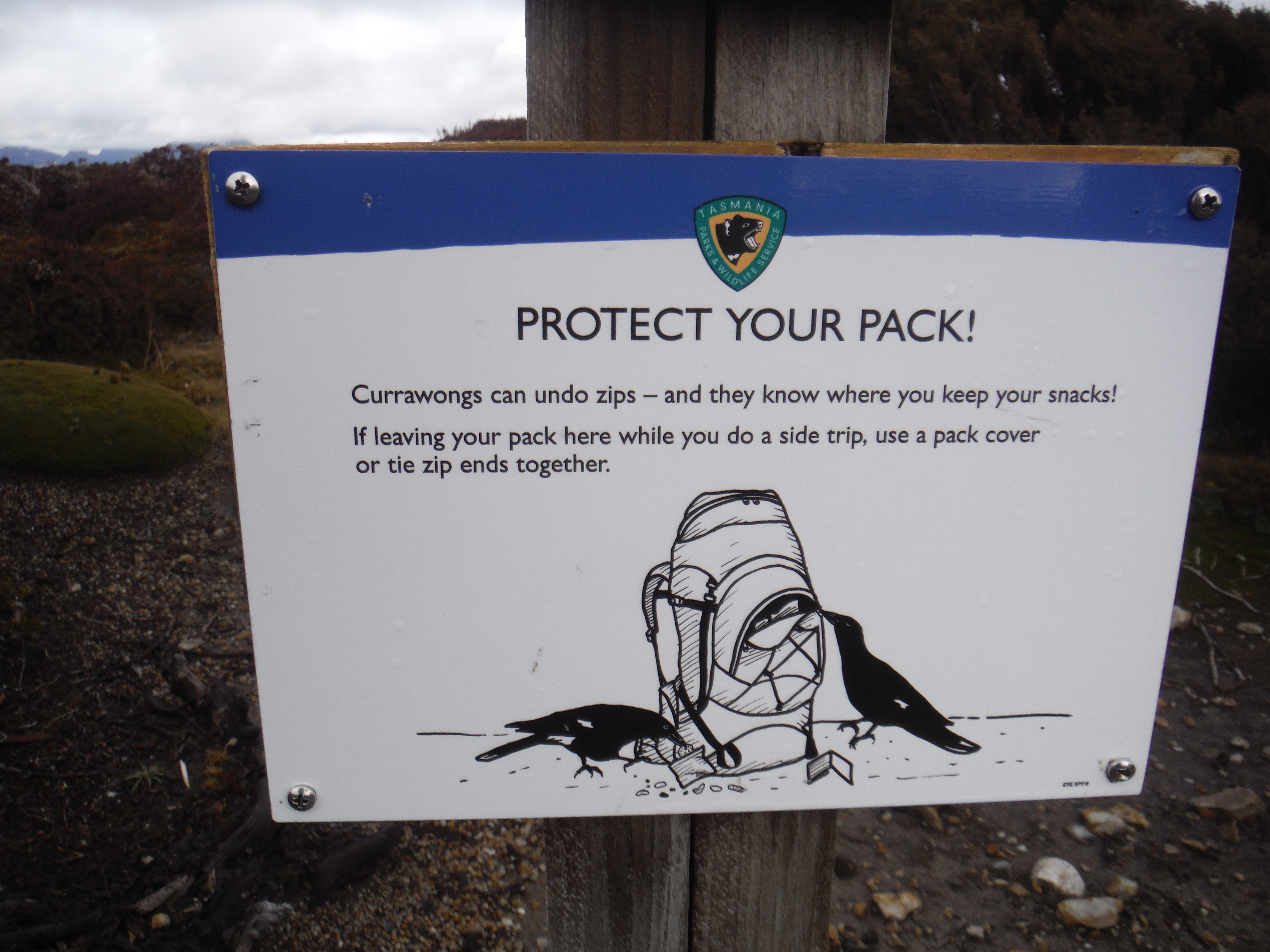
So in the grand tradition of ‘don’t think, just do’, we took the path to the right. Firstly though, we had to cover our packs. Warning signs had been placed on the trails warning of the cunning currawongs, these glorious black birds that have evolved to learn how to undo zips on bags and go through all of your stuff. I put my pack cover over the top of my bag, put my bag down and started on my way.
Not being able to see what it is that you are climbing exactly makes things a little ambiguous. At first I thought we were going up Mount Doris. But then I realized that it was not high enough and going to be too easy, so around the side of Mount Doris we went and there we were, at the foot of Mount Ossa, ready to go.

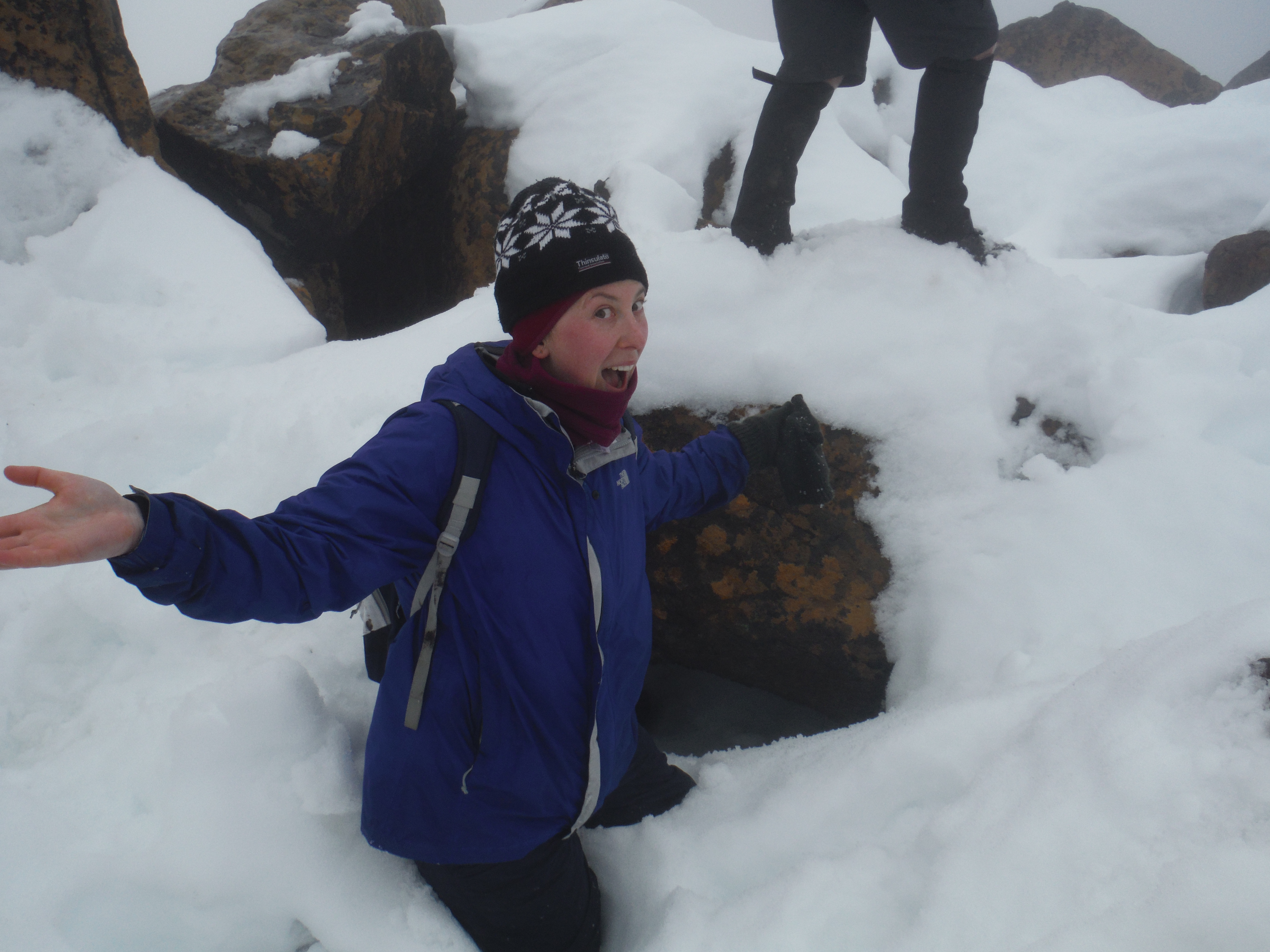
About half way up, we started to encounter the snow and the low level cloud to the point where it became difficult to see anything more than the footprints in the snow in front of you, more snow and some rocks sticking out of it. The wind started roaring and it became difficult to climb. At one point I thought to myself, “I can’t do this. It is too dangerous. It is too windy. I can’t get up this channel that the wind is just beating down in”. Some of the girls we had been staying with in the hut came around the corner at the top and told us that the wind is not bad on the other side and all we had to do was to make it to the top of the narrow and windy alley. So we persisted. Slowly. Carefully. And eventually rounded the top of the wind tunnel into the haven of the wind-free other side of the mountain.

From here it was another half an hour of walking. As the days had progressed we had laughed about ‘going deep’, a term that we used every time somebody stepped into a puddle so deep that the muddy water seeped over the top of your boot and down into your shoes. This half an hour of walking took the term ‘going deep’ to a completely new level. At times the footing was so unstable you would find yourself ass deep in snow with your feet stuck and you would literally have to climb your way out.
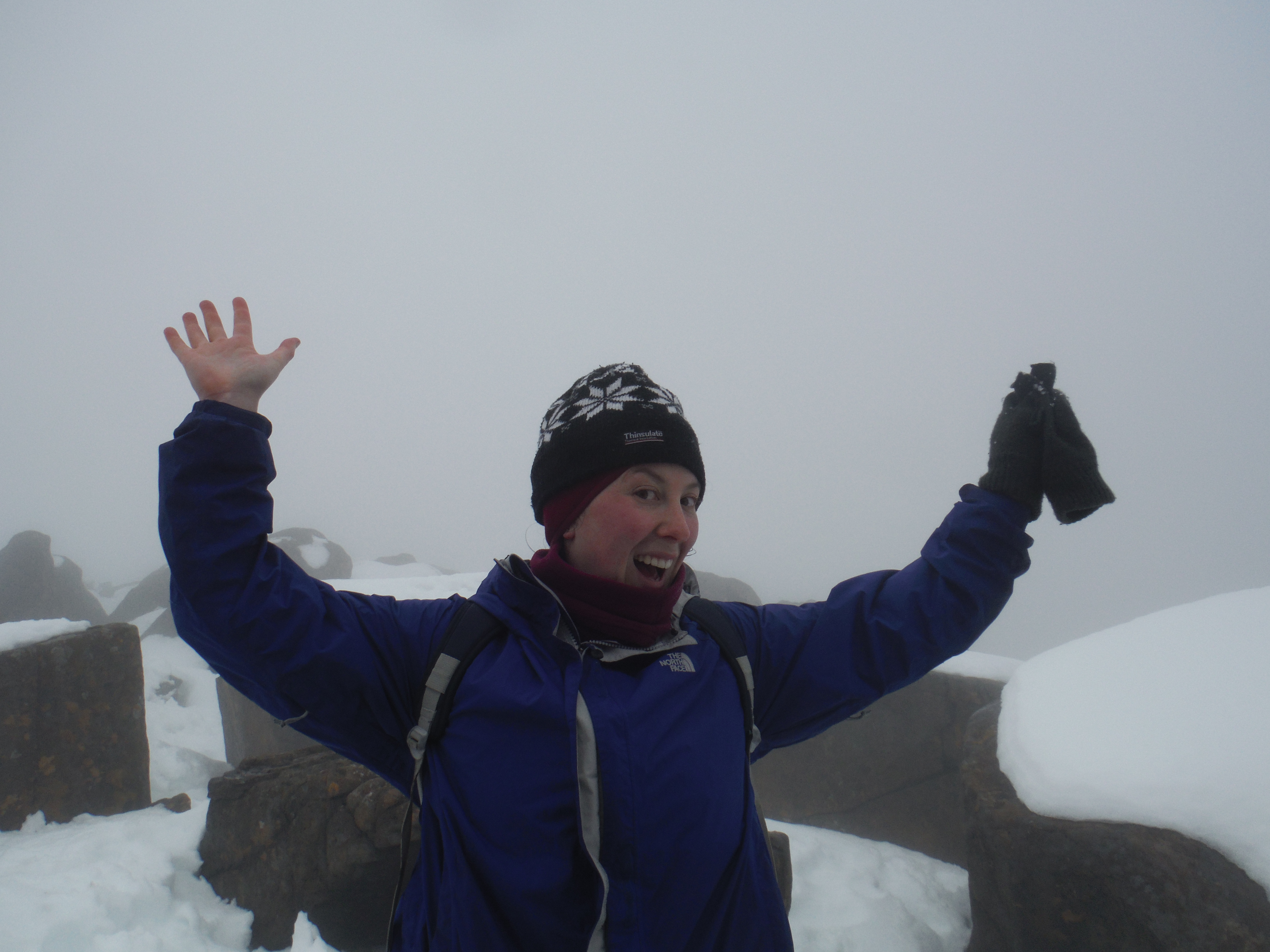
At some point, the footprints in the snow stopped. And after consultation with the GPS, we realized that we were indeed at the top. 1617m, and the top of Tasmania. The boys took part in customary underpants photos and we started our way back down the hill.
Given the downward momentum and that it was pretty hairy trying to walk down for fear of ‘going deep’ it was easier for the most part to slide down the snow on your butt trying to avoid rocks. It was actually really fun and in some places you could work up a bit of speed. We rounded the bend into the giant wind tunnel again, managed to get down safely and continued back down the hill.
An hour later, the rest of the world appeared out of the bottom of the clouds and the surreal feeling of being in the snow in a white out disappeared. It was back to business as usual, back to the packs, and back on the trail to get to the next hut, the Kia Ora hut.

Only one thing was problematic….. those cheeky Currawongs! They had managed to evolve further to chewing through elastic to remove my pack cover, open my top zip, disperse my phone, wallet, toothpaste, hand sanitizer, toilet paper and anything else they could get their grubby beaks on all over the platform. Despite not being the only one who had their pack broken into for the day (it happened to about five people), I would never hear the end of it. “Forget being smarter than a fifth grader, because you aren’t smarter than a bird”.
Stay tuned for the final installment of the Overland Track……
